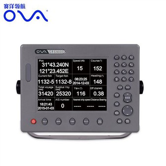
gps marine navigation
Marine gps navigator with chartplotter, 17 Inch Dual System Marine Electronics Chart Plotter System Product performance ● The electronic sea map is including global map, supporting vector map IHO,S57,S63 and RNC raster sea chart ● Flexible expandability and many navigation sensor interfaces...
Product Introduction
GPS marine navigation with chartplotter, 17 Inch Dual System Marine Electronics Chart Plotter System
Product performance
●The electronic sea map is including global map, supporting vector map IHO,S57,S63 and RNC raster sea chart
●Flexible expandability and many navigation sensor interfaces allow the ECS to be networked with AIS,GPS,Echo Sounder,Compass,Log,ARPA and others to consolidate the navigation system
●17 inch industrial display screen provides high resolution of 1280x1024
●The electronic chart can be overlaid with a variety of navigation data such as ship’s position, heading,speed and others to facilitate safe and efficient navigation
●Navigation data for the past 12 hours can be recorded and playback
●CERTIFICATED by China Classification Society
●CERTIFICATED by Register of Fishing Vessel of The People’s Republic of China
Technical Specification:
Model | ECS9000 |
 | |
Power Supply | DC24V(16-35V) |
Power | High-performance, full isolated, PWM control of power supply |
Installation | Desk,Bracket or Embedded |
Display Unit | |
Type | 17” |
Screen Resolution | 1280*1024px |
Language | Simplified Chinese, English |
Characteristics | |
Chart Format | IHO S57,S63(ENC),RNC |
Display Modes | North-Up、SouthUp、Route-Up、Head-Up |
Display of Data | Own ship:Position,COG,SOG,Heading; Others:Cursor Data、Target information、Navigation、EBL、VRM |
Route/Waypoint | Routes≥100;Waypoints≥5000 |
Alarm | Off track,Communication,Position,Collision,Alert area,Hazardous material |
Voyage Calculation | Range/Bearing to Destination,Off track,TTG,ETA |
Navigation Log | ≥12h |
Track Display | ≥240min |
Other Functions | Measurement(Distance,Bearing,CPA/TCPA),User chart function,Log book,Night/day presentation colors,ARPA target display |
Interface | |
Input/Output | GPS(GGA,GLL,GSA,GSV,RMC,VTG) |
Input | AIS(VDM,ABM,BBM),compass(HDT),Speed log(VBM), Echo Sounder(DBT,DPT),Water temp Indicator(MTW), Anemometer(MWV),Current Indicator(VDR) |


We could customize the marine GPS chart plotter with multilingual, and our gps marine navigation adopt Windows operating system. GPS marine navigation with chartplotter, Electronic Chart System can cover all kinds of navigation data, it can connect with ECS, AIS, GPS, Echo Sounder, Compass, Speed Log, ARPA and other devices to support more stable navigation system.
Hot Tags: gps marine navigation, manufacturers, suppliers, wholesale, custom, buy, best, price, on sale, for sale, marine gps navigator, navigator marine electronics, marine gps navigator with chartplotter, boat gps marine gps navigator, marine fishing navigator
You Might Also Like
Send Inquiry


