
Chart Plotter with Built in AIS Transmitter Receiver
MARINE gps marine chart plotter ●Independent research and development of GPS receiver board, positioning accuracy, high stable speed and course ●Support GPS + Beidou Accurate positioning Professional Grade Performance without the High End Price Tag Marine GPS Waterproof Sunlight Viewable OVA gps...
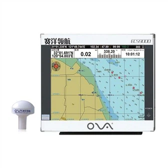
Product Introduction
We are determined to become a supplier that can provide complete solutions for high-quality 1kw transducer, professional fish finder, nmea0183 echo sounder ultrasonic transducer. Looking forward to growing up with you. Our company will further take the market as the guide, technology as the backing, management as the guarantee, to provide services to the majority of users. We are committed to creating a favorable environment for talents to stand out and make the best use of their talents.
GPS marine chart plotters are widely used for navigation at sea, integrating electronic navigation charts with GPS data.
●Independent research and development of GPS receiver board, positioning accuracy, high stable speed and course
●Support GPS + Beidou Accurate positioning
Professional Grade Performance without the High End Price Tag
Marine GPS Waterproof Sunlight Viewable
Performance Parameter of the Gps Marine Chart Plotter
| |
Model | GBS9000-08 |
Power Supply | DC 24V(11~35V) |
Power Consumption | 15+1W |
Power | High-performance, full isolated PWM control of power supply |
Mount | Bracket Mount or Flush Mount |
Display Size | 8’’ |
Screen Resolution | 800*600px |
Language | Simple Chinese, English, Traditional Chinese |
Navigation Characteristics | |
Data Storage | Waypoints:6000;Marks:5000,Routes:200, 48 waypoints/Route Tracks≤800 (Track Points≤20000) |
Data Display | Suspension Data: Information of ship’s latitude, longitude, fish zone, speed, course; Navigation information of waypoints and routes; Time, date and so on. |
Other Functions | Tide and Compass Pages; AIS Display and Alarm, AIS Message, Vessel Management(if input AIS) |
GPS Characteristics | |
Receive Type | GPS/Glonass/Galileo/Beidou |
Receive Channel | GPS: 1575.42MHz(L1) Beidou: 1561.098MHz(L) |
Aquisition Time | Cold Start: 45s Hot Start: 15s |
Accuracy | GPS:<13m(95%) Beidou: Horizontal 25m(95%) Vertical 30m(95%) |
Interface | |
Input/Output | GPS/Beidou(GGA, GSA, GLL, GSV, RMC, VTG) |
Output | AIS(VDM) |
SD Card | Update software and chart, import and export data |


OVA gps marine chart plotter, Independent research and development of GPS receiver board, positioning accuracy, high stable speed and course.We have a wide range of products to meet your every Marine navigation need.
Strengthening the brand building is an important means to enhance the competitiveness of our Chart Plotter with Built in AIS Transmitter Receiver. Relying on the company's unremitting technological innovation and senior R&D team for many years, we gain a certain position in the industry. After years of re exploration, re optimization and re practice, our company has basically formed a long-term mechanism of strategic management.
Hot Tags: gps marine chart plotter, manufacturers, suppliers, wholesale, custom, buy, best, price, on sale, for sale, boat gps fish finder, Stainless Steel Transducer, marine transducers, navigator marine electronics, Satellite Compass, underwater depth transducer
You Might Also Like
-

17" AIS Transponder Class B Marine GPS Navigator Chartplotter
-

a-Td33 200kHz Sonar Small Waterproof Ultrasonic Transducer
-

8" Echo Depth Sounder with Transducer
-
Satellite Emergency Radio Position Indicator Vdr/Vdr - Sc (VEP8V)
-

Big Power Ultrasonic Transducer for Fish Finder or Echo Sounder Td47t
-

5.6-Inch Depth Sounder and Fish Finder
Send Inquiry