

Multifunction Instrument
Products Description of the mi42 Multifunction Instrument This series of products adopts NMEA0183 protocol, conforms to the relevant performance standards of IMO (International Maritime Organization), supports a variety of data display, and can display functions for many marine equipment....
Product Introduction
mi42 Multifunction Instrument | NMEA 0183 Marine Data Display with 4.2" Color Screen
The SAIYANG mi42 Multifunction Instrument is a professional marine display that connects to any NMEA 0183 network to visualize critical navigation and environmental data. Designed to meet IMO performance standards, this 4.2-inch high-resolution instrument replaces multiple dedicated gauges by showing GNSS, wind, depth, compass, speed log, rudder angle, barometric pressure, temperature, humidity, and more on one customizable screen. It is the ideal monitoring solution for commercial vessels, workboats, and cruising yachts.
Why Choose the mi42 Multifunction Instrument?
Modern vessels generate abundant NMEA 0183 data, but many displays are single-purpose or difficult to read in sunlight. The mi42 solves this by aggregating data from multiple sensors (GPS, wind meter, satellite compass, depth sounder, etc.) and presenting it clearly on a bright, 720x672 color display. With built-in data logging, race timer, and flexible configuration, it provides a complete helm display without complex integration or high costs.
Key Features & Benefits
- All-in-One Data Display: Shows up to 11 data types: GNSS, attitude, rate of turn (ROT), rudder angle, heading (HDT), barometric pressure, air temperature, humidity, water temperature, wind speed/direction, set & drift, mileage, and speed through water.
- High-Resolution 4.2" Color Screen: 720x672 pixel resolution with automatic day/night modes (black, white, black/green) for perfect readability in direct sun or dark bridge conditions.
- NMEA 0183 (RS422) Connectivity: Standard marine protocol ensures easy integration with existing sensors, plotters, and Saiyang wind meters or satellite compasses.
- Historical Data Graphs: View 12-hour trends of depth, water temperature, speed over water, air temperature, pressure, wind, heading, and more - essential for weather planning and vessel performance analysis.
- Wind & Performance Functions: Calculates three wind levels and maximum wind speed. Includes a dedicated race timer for sailing regattas and practice sessions.
- Data Recording & Logging: Automatically records historical course, heading, and depth data for later review.
- Customizable Interface: Multi-language support, adjustable brightness via external control, and flexible screen layout.
- Rugged & Waterproof: IPX7 rated (protected against immersion), operates from -18°C to +58°C, and withstands 96% humidity.
Supported Data Types (NMEA 0183 Sentences)
The mi42 displays and logs the following information from your vessel's NMEA network:
- Navigation: GNSS position, speed over ground, course over ground, heading (HDT), rate of turn (ROT)
- Environment: Wind speed & direction (apparent/true), barometric pressure, air temperature, humidity, water temperature
- Vessel Dynamics: Speed through water (log), set & drift, mileage, rudder angle, attitude (pitch/roll)
- Logging: Historical course, heading, depth, and wind extremes
Typical Applications
- Sailing Yachts & Racing Boats: Use the race timer, wind data, and historical graphs to optimize upwind performance and race strategy.
- Commercial Workboats: Monitor depth, speed, heading, and environmental conditions from a single, rugged display.
- Bridge Retrofit: Replace multiple analog gauges with one modern, backlit digital display.
- Secondary Helm Station: Add a compact but complete data display at a flybridge or inside cabin.
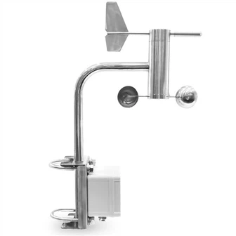
- With Saiyang Sensors: Directly connect and configure Saiyang wind meters and satellite compass sensors.
Installation & Wiring
The mi42 comes with clearly labeled connectors for power, NMEA 0183, and optional brightness control. Standard RS422 wiring (RX+, RX-, TX+, TX-) allows easy interfacing with any talker or listener. The 9-36V power range ensures compatibility with both 12V and 24V electrical systems. A dimensional drawing is available for cutout planning. For detailed pinouts, refer to the product manual or contact our technical support team.
Why Buy from SAIYANG?
SAIYANG is a direct manufacturer of marine instrumentation, including multifunction displays, NMEA buffers, wind sensors, and satellite compasses. By buying wholesale from us, you get:
- Factory-direct pricing with no middleman markup
- Customizable options (OEM logos, language, default screens)
- Pre-shipment testing and 1-year warranty
- Technical support from marine electronics engineers
- Fast global shipping
Contact us for the best price on bulk orders or for assistance integrating the mi42 into your NMEA 0183 network.
Technical specification of the mi42 Multifunction Instrument
|
Dimensions |
Refer to Dimensional Drawing |
|
Weight |
185g |
|
Power consumption |
3 W |
|
Color |
Black |
|
Display |
|
|
Size |
4.2 inch |
|
Resolution |
720*672 |
|
Illumination |
Day mode is black, day reverse color is white, night mode is black and green |
|
Environmental protection |
|
|
Waterproof rating |
IPX7 |
|
Humidityl |
96% RH |
|
Temperature |
|
|
Operating |
-18℃ ~ + 58℃ |
Hot Tags: multifunction instrument, manufacturers, suppliers, wholesale, custom, buy, best, price, on sale, for sale
You Might Also Like


Send Inquiry