
High Performance 3G Waterproof GPS Tracker for Boat/Fleet /Truck with FCC Approval (TK119-3G)
MARINE gps marine chart plotter ●Independent research and development of GPS receiver board, positioning accuracy, high stable speed and course ●Support GPS + Beidou Accurate positioning Professional Grade Performance without the High End Price Tag Marine GPS Waterproof Sunlight Viewable OVA gps...
Product Introduction
We emphasize the development of products and technological innovation, and produce our boat gps marine gps navigator, gps marine navigation, echo sounder transducer fish finder transducer with scientific and stable concepts. Our company always regards the quality of products as the life of the enterprise, the service as the soul of the enterprise and the customer satisfaction with the company as the standard of testing the enterprise. In the market economy tide, we pioneer and innovate, forge ahead, and constantly open up new business areas and expand new market space.
GPS marine chart plotters are widely used for navigation at sea, integrating electronic navigation charts with GPS data.
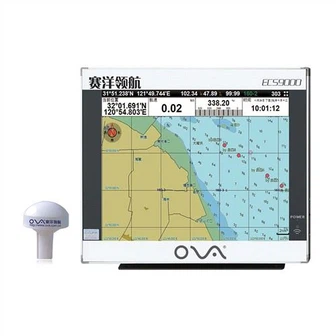
●Independent research and development of GPS receiver board, positioning accuracy, high stable speed and course
●Support GPS + Beidou Accurate positioning
Professional Grade Performance without the High End Price Tag
Marine GPS Waterproof Sunlight Viewable
Performance Parameter of the Gps Marine Chart Plotter
| |
Model | GBS9000-08 |
Power Supply | DC 24V(11~35V) |
Power Consumption | 15+1W |
Power | High-performance, full isolated PWM control of power supply |
Mount | Bracket Mount or Flush Mount |
Display Size | 8’’ |
Screen Resolution | 800*600px |
Language | Simple Chinese, English, Traditional Chinese |
Navigation Characteristics | |
Data Storage | Waypoints:6000;Marks:5000,Routes:200, 48 waypoints/Route Tracks≤800 (Track Points≤20000) |
Data Display | Suspension Data: Information of ship’s latitude, longitude, fish zone, speed, course; Navigation information of waypoints and routes; Time, date and so on. |
Other Functions | Tide and Compass Pages; AIS Display and Alarm, AIS Message, Vessel Management(if input AIS) |
GPS Characteristics | |
Receive Type | GPS/Glonass/Galileo/Beidou |
Receive Channel | GPS: 1575.42MHz(L1) Beidou: 1561.098MHz(L) |
Aquisition Time | Cold Start: 45s Hot Start: 15s |
Accuracy | GPS:<13m(95%) Beidou: Horizontal 25m(95%) Vertical 30m(95%) |
Interface | |
Input/Output | GPS/Beidou(GGA, GSA, GLL, GSV, RMC, VTG) |
Output | AIS(VDM) |
SD Card | Update software and chart, import and export data |


OVA gps marine chart plotter, Independent research and development of GPS receiver board, positioning accuracy, high stable speed and course.We have a wide range of products to meet your every Marine navigation need.
As the industry leader in this field, our products are being used in various countries and regions worldwide, we believe that our High Performance 3G Waterproof GPS Tracker for Boat/Fleet /Truck with FCC Approval (TK119-3G) can help you to develop and maintain a competitive advantage. We adhere to our solemn commitment to serve society and create harmony, and actively fulfill our social responsibility. We integrate the value concept into the management system and transform it into the conscious action of employees.
Hot Tags: gps marine chart plotter, manufacturers, suppliers, wholesale, custom, buy, best, price, on sale, for sale, 1kw transducer, chart plotter marine gps navigator, ova marine rubber transducer, nmea 0183 depth transducer for sale, BOAT SONAR FISH FINDER, professional fish finder
You Might Also Like
-

19 Inch Marine AIS System Class B GPS Chartplotter
-

Nmea0183 Tester (sender&reader)
-

a-Td26 Marine Echo Sounder Depth Transducer
-

FF-1108-1cw Lucky Wireless Fish Finder 2~147FT Colored LCD Fishfinder Sensor Sonar Detector Fishing
-
Personal Locator Beacon with GPS 406MHz
-
Human Body Temperature Measurement Monitoring Access Control System
Send Inquiry