


10inch Boat Electronics GPS Navigation Chart Plotter
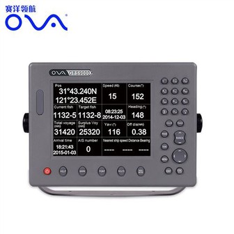
MARINE gps marine chart plotter ●Independent research and development of GPS receiver board, positioning accuracy, high stable speed and course ●Support GPS + Beidou Accurate positioning Professional Grade Performance without the High End Price Tag Marine GPS Waterproof Sunlight Viewable OVA gps...
Product Introduction
In order to meet the needs of product upgrading in the new era, our company actively explores new materials and new processes for Gps Marine Chart Plotter, Marine Transducer 200khz, gps marine navigation based on the original production technology. According to the career characteristics of employees, we provide a platform to show their talents and emphasize performance-oriented employment. We pursue perfection in every detail and carry out strict quality control on every process.
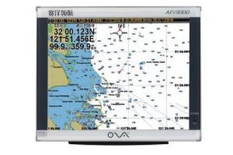
GPS marine chart plotters are widely used for navigation at sea, integrating electronic navigation charts with GPS data.
●Independent research and development of GPS receiver board, positioning accuracy, high stable speed and course
●Support GPS + Beidou Accurate positioning
Professional Grade Performance without the High End Price Tag
Marine GPS Waterproof Sunlight Viewable
Performance Parameter of the Gps Marine Chart Plotter
| |
Model | GBS9000-08 |
Power Supply | DC 24V(11~35V) |
Power Consumption | 15+1W |
Power | High-performance, full isolated PWM control of power supply |
Mount | Bracket Mount or Flush Mount |
Display Size | 8’’ |
Screen Resolution | 800*600px |
Language | Simple Chinese, English, Traditional Chinese |
Navigation Characteristics | |
Data Storage | Waypoints:6000;Marks:5000,Routes:200, 48 waypoints/Route Tracks≤800 (Track Points≤20000) |
Data Display | Suspension Data: Information of ship’s latitude, longitude, fish zone, speed, course; Navigation information of waypoints and routes; Time, date and so on. |
Other Functions | Tide and Compass Pages; AIS Display and Alarm, AIS Message, Vessel Management(if input AIS) |
GPS Characteristics | |
Receive Type | GPS/Glonass/Galileo/Beidou |
Receive Channel | GPS: 1575.42MHz(L1) Beidou: 1561.098MHz(L) |
Aquisition Time | Cold Start: 45s Hot Start: 15s |
Accuracy | GPS:<13m(95%) Beidou: Horizontal 25m(95%) Vertical 30m(95%) |
Interface | |
Input/Output | GPS/Beidou(GGA, GSA, GLL, GSV, RMC, VTG) |
Output | AIS(VDM) |
SD Card | Update software and chart, import and export data |


OVA gps marine chart plotter, Independent research and development of GPS receiver board, positioning accuracy, high stable speed and course.We have a wide range of products to meet your every Marine navigation need.
We're commitment to offer you the aggressive cost, superb products and solutions top quality, too as fast delivery for 10inch Boat Electronics GPS Navigation Chart Plotter. We are looking forward to establishing business relationship with you. According to the market segmentation and target market selection, our company determines the brand positioning of our company.
Hot Tags: gps marine chart plotter, manufacturers, suppliers, wholesale, custom, buy, best, price, on sale, for sale, navigator marine electronics, ais marine gps chart plotter, Marine Boat Depth Transducer, 1kw transducer, BOAT SONAR FISH FINDER, gps boat marine gps ais
You Might Also Like
-

Single-Frequency Echo Sounder with CCS Approval
-

Ranked Top 10 Best Hand Hold Sonar Fishfinder
-
Pressure Transducers Suppliers Diaphragm Flush Pressure Transducer
-
High Performance 3G Waterproof GPS Tracker for Boat/Fleet /Truck with FCC Approval (TK119-3G)
-
500kHz Stainless Steel Ultrasonic Depth Transducer for Underwater Rangefinder
-

FF-718 Wired 80m Professional Fish Finder W/ Sonar Transducer
Send Inquiry