


Digital Magnetic Compass Modbus Protocol or Hexadecimal Protocol 3D Pitch Roll Heading Yaw Sensor RS232 RS485 Ttl for Crane Antenna Satellite etc
GPS COMPASS GNSS-powered high accuracy compass High precision and accurate heading of 0.4° (GSC620) Perfect for Radar, ECDIS, AIS, Doppler Sonar and Autopilots Features: GSC620 provides a high system accuracy for the heading of the ship, 0.4° Provides highly accurate heading data for Autopilot,...
Product Introduction
Our fishfinder chartplotter transducer, professional fish finder, Marine Transducer 200khz are far superior to similar products on the market in terms of performance and price. With all those advantages, we are going to create'the reputable international brand of nylon monofilaments', and spreading our products to every corner of the world. Warm tips: the price of raw materials of our products will fluctuate, so the prices of finished products will be different. We will strengthen the coverage and management of different sales areas. After several years of ups and downs, we have accumulated rich experience in industry operation and management. We follow the standard requirements of 'professionalism, classicism and quality', and are well received and praised by customers with excellent service.
Marine Satellite compass Provides highly accurate heading data for Autopilot, Radar, ARPA, Scanning Sonar, Current Indicator, Chart Plotter, ECDIS and Autopilot.
Product Introduction
Satellite Compass SC90 provides a high system accuracy for the heading of the ship, 0.4°
- CCS CERTIFICATE
- MED CERTIFICATE
- Optional Display instrument
Satellite Compass
(GPS/GALILEO/BEIDOU/GLONASS):
- Front-loaded carrier phase decoding technology, more accurate orientation;
- Multi-star system, with faster directional speed;
- Advanced speed and course filtering technology to make the data more stable;
- Built-in gyro compensation system has better heading performance; It has the characteristics of fast start, signal recapture, heading update up to 50 times per second, and turning rate up to 90°/s;
- Multi-channel standard NMEA0183 output, providing high-stability, high-precision ship heading data and positioning data for Radar, ARPA, ECDIS, AIS, Chart Plotter, Autopilot, Sonar and other marine navigation equipment;
- Excellent industrial product design, stylish appearance, easy installation;
- Maintenance free and no recurring cost as there are no mechanical parts.

Client Feedback


TRUE MOTION TARGET TRAILS

TRUE MOTION TARGET TRAILS

TRUE MOTION TARGET TRAILS


Interconnection Diagram

Differences between Satellite Compass, gyro compass and magnetic compass

How Marine Satellite Compass Solves Your Navigation Pain Points
Designed for all types of marine vessels-from small coastal boats to large commercial ships-the Marine Satellite Compass eliminates the frustrations that plague traditional magnetic or gyro compasses, turning unreliable navigation into precise, stress-free operation. Unlike magnetic compasses that suffer from magnetic interference (from engines, radar, or metal structures) and require constant calibration, or gyro compasses that are bulky, high-maintenance, and prone to drift, this satellite-based compass leverages multi-constellation GNSS technology (GPS, GLONASS, Galileo, and Beidou) to deliver consistent, high-accuracy heading data-even in the harshest maritime conditions. It directly addresses the core issues mariners face: inaccurate heading readings in high-latitude regions, signal disruptions from magnetic interference, time-consuming calibration, and costly maintenance downtime.
Whether you're navigating through congested ports needing precise berthing, sailing in remote offshore areas with no visual references, or operating a commercial vessel requiring IMO-compliant navigation data, this device adapts to your needs. With a heading accuracy of ±0.4°, it provides real-time true heading, course over ground (COG), speed over ground (SOG) for safe maneuvering. It integrates seamlessly with ECDIS, radar, AIS, and autopilot systems, requires no regular calibration, and boots up in just 90 seconds-letting you focus on navigation rather than troubleshooting equipment. Built with rugged, weatherproof components (IP56-rated antenna) to withstand salt spray, extreme temperatures, and rough seas, it's a low-maintenance solution that delivers reliable performance for years, eliminating the recurring costs of traditional compass upkeep.
FAQ

01. Why am I getting inaccurate heading readings, especially near the ship's engine or radar?
02. Does this Marine Satellite Compass comply with international maritime regulations (IMO, IEC)?
03.What maintenance does the compass require?
04. Can it integrate with my existing navigation systems (ECDIS, radar, autopilot)?
05. Does the device work in high-latitude regions or under bridges/tall structures?
Product Parameter(Specification)
1. General
|
1.1 Receiving frequency |
GPS/GALILEO/BEIDOU/GLONASS (optional) |
|
1.2 Heading accuracy |
|
|
SC90 |
0.4°RMS |
|
1.3 Heading resolution |
0.1°,0.01°(0.01° requires contact your dealer) |
|
1.4 Rate of Turn |
90°/s |
|
1.5 Position fixing time |
less than 2min |
|
1.6 Attitude accuracy |
Pitch/Roll: 0.3°RMS |
|
1.7 Power supply |
DC11-32V |
2. Interface
|
2.1 Number of port |
|
|
IEC61162(NMEA0183) |
IEC61162-2: 2 port, IEC61162-1: 2 port |
|
AD-10 |
2 port, for heading output |
|
BAM/INS |
2 port |
|
2.2 Data port/Alert port |
|
|
Input |
ACN, HBT |
|
Output |
ALC, ALF, ARC, HBT, HDT, RMC, ROT, THS, HCR GBS*, GGA*, GLL*, GNS*, GRS*, GSA*, GST*, GSV*, HDG*, VTG*, ZDA*, |
|
2.3 Output proprietary sentences |
SHR* |
Note: output the sentence with * requires contact your dealer.
3.Environmental conditions
|
3.1 Ambient temperature |
|
|
Antenna unit |
-25 ℃ to 70 ℃ |
|
Junction box |
-15 ℃ to +55 ℃ |
|
3.2 Relative humidity |
95% or less at +40 ℃ |
|
3.3 IP protection |
|
|
Antenna unit |
IP56(Exposed) |
|
Junction box |
IP20(Protected) |
|
3.4 Vibration |
IEC 60945 Ed.4 |
We offer great strength in quality and development, merchandising, sales and marketing and operation for Digital Magnetic Compass Modbus Protocol or Hexadecimal Protocol 3D Pitch Roll Heading Yaw Sensor RS232 RS485 Ttl for Crane Antenna Satellite etc. We are also frequently hunting to determine relationship with new suppliers to deliver impressive and good option to our valued buyers. We believe that with high-quality products, reasonable prices, considerate and efficient service and good communication and cooperation capabilities, we will create a better cooperative relationship with you.
Hot Tags: marine compass, manufacturers, suppliers, wholesale, custom, buy, best, price, on sale, for sale, depth sounder transducer, Satellite Compass, gps navigation for boat, nmea0183 echo sounder ultrasonic transducer, transducer for fishfinder, ova marine rubber transducer
You Might Also Like
-

Ova 12 Inch AIS Transponder & GPS Marine with Chartplotter for Fishing Boat
-
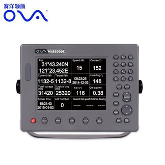
T100 Boat Best Marine GPS Chart Plotter for Sale
-

FF-518ru Russian Version Wrist Watch Wireless 45m Fish Finder Clock Mode Colored LCD Display
-
T100 10" Marine GPS Navigation System GPS Chart Plotter
-
Ova 12 Inch Marine AIS Transponder & GPS Chart Plotter Ship Navigator
-
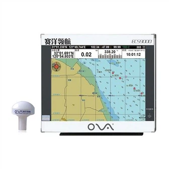
New 8 Inch Marine Navigational Equipment GPS Navigator for Boat
Send Inquiry